中山道
Nakasendo
Walking an Ancient Mountain Road
Photo Essay · No. 001
The Nakasendo is an Edo-period mountain road that connected Kyoto and Edo through the Kiso Valley of central Japan. In June 2025 I walked its best-preserved section over five days, with a camera. This is the record of that walk.
The Village on the Mountain
馬籠宿
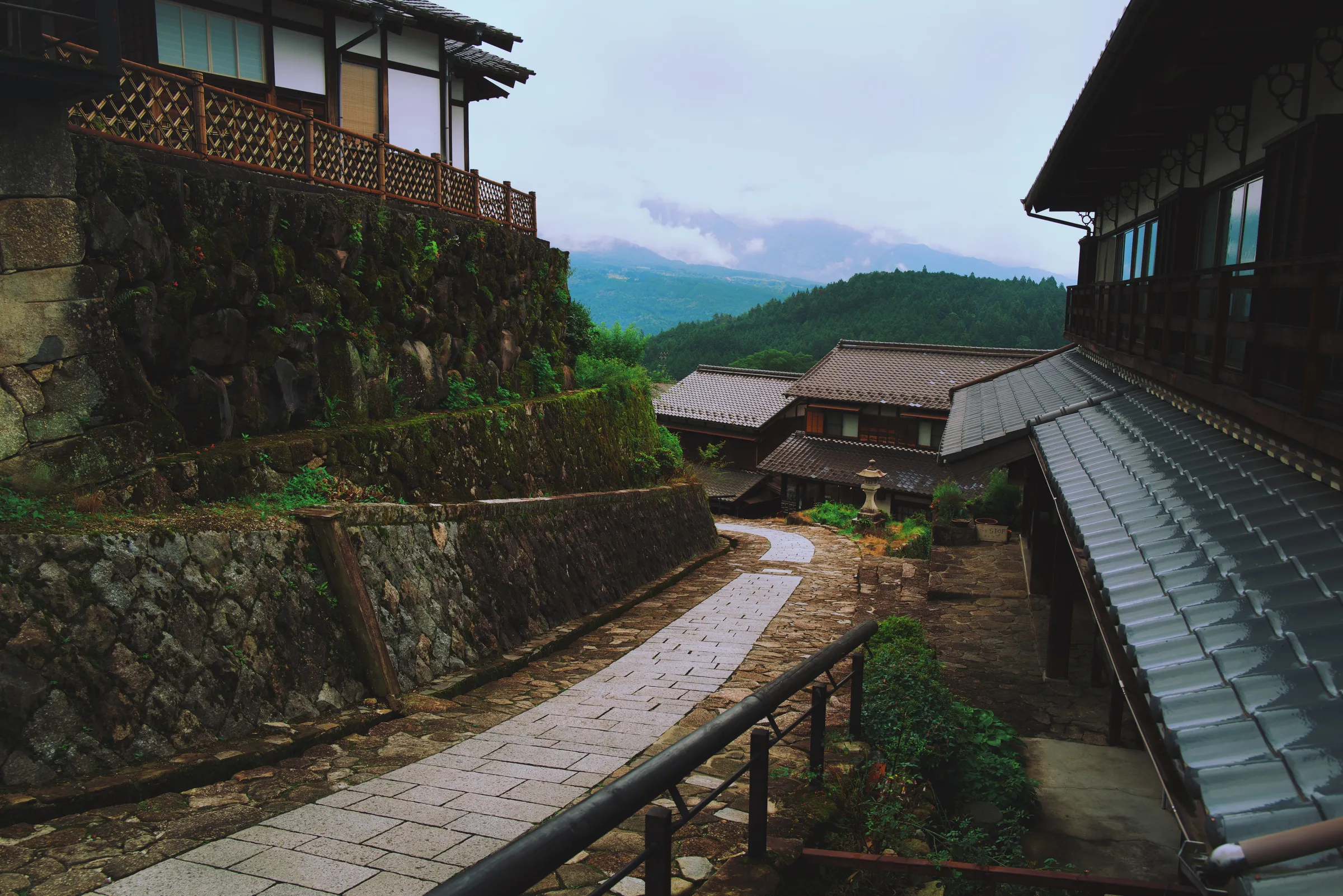
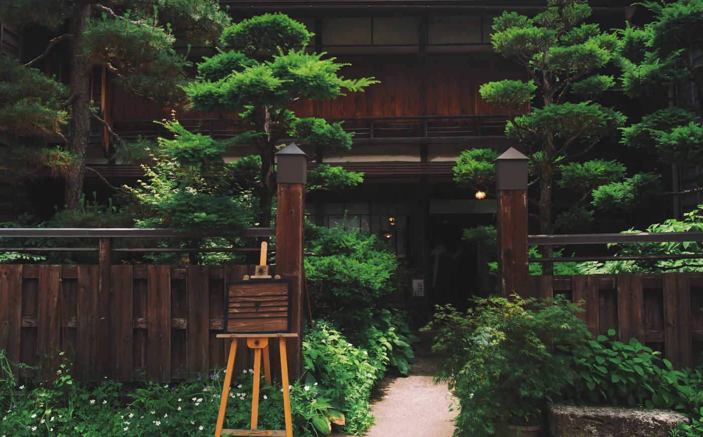
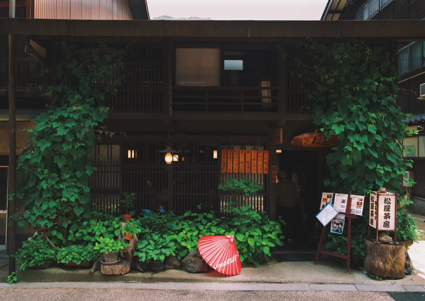
Magome is a place clearly made for people before people made places for cars. The single narrow road ascends steeply up the mountainside, lined with the kinds of buildings that became the staples of the post-towns: inns, shops, restaurants, all built to serve the needs of travelers four hundred years ago, and still at it. The morning moved slowly — coffee at Hirubiri twice, then Cafe Kappe — before the trail finally left the village behind.
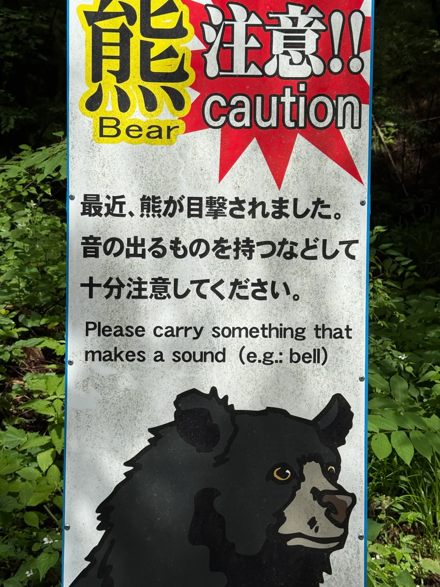
As the road climbed above the rooftops and into the deep cedar forest, frequent bear warning signs were a reminder that this was not just a tourist attraction but a real path through real mountains. The trail was steep and the air thick with humidity. I had been warned that the route was too hot to walk in June, and was relieved to find it almost entirely to myself.
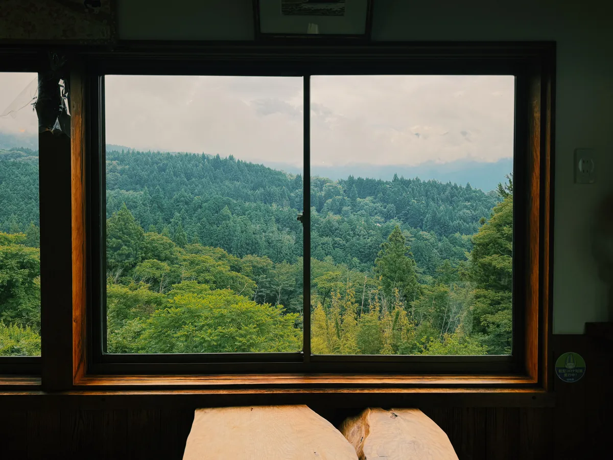
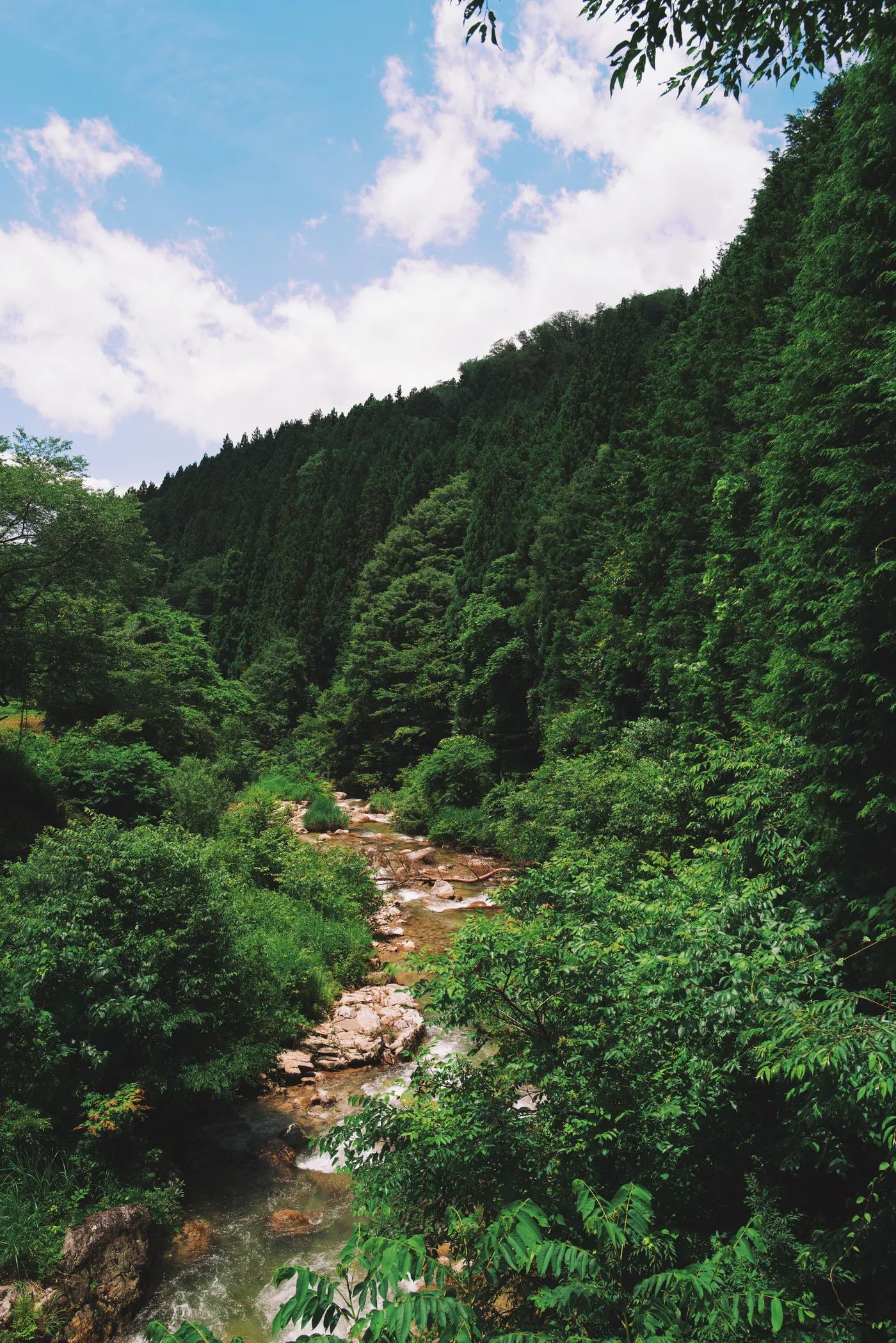
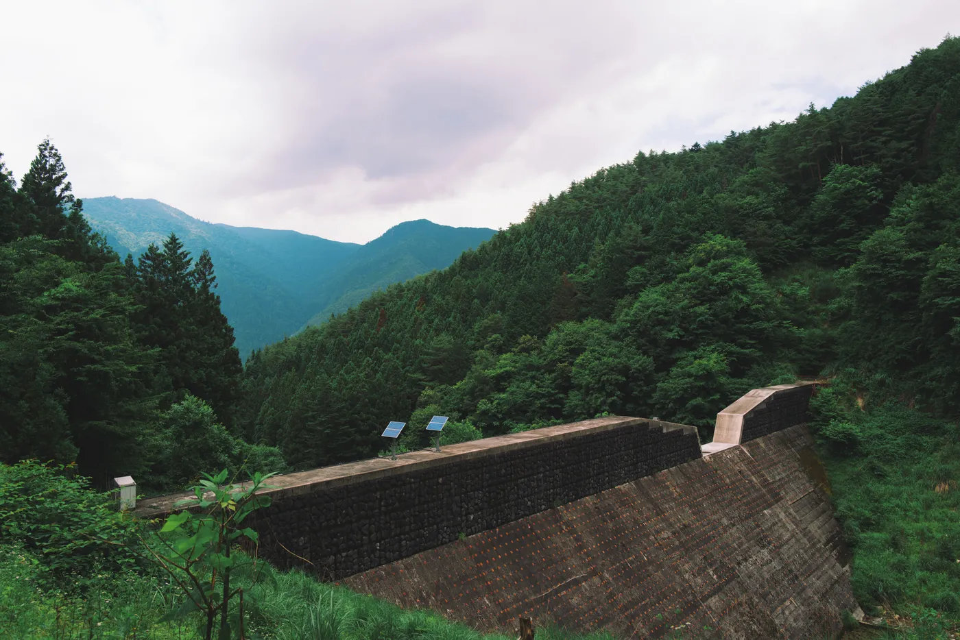
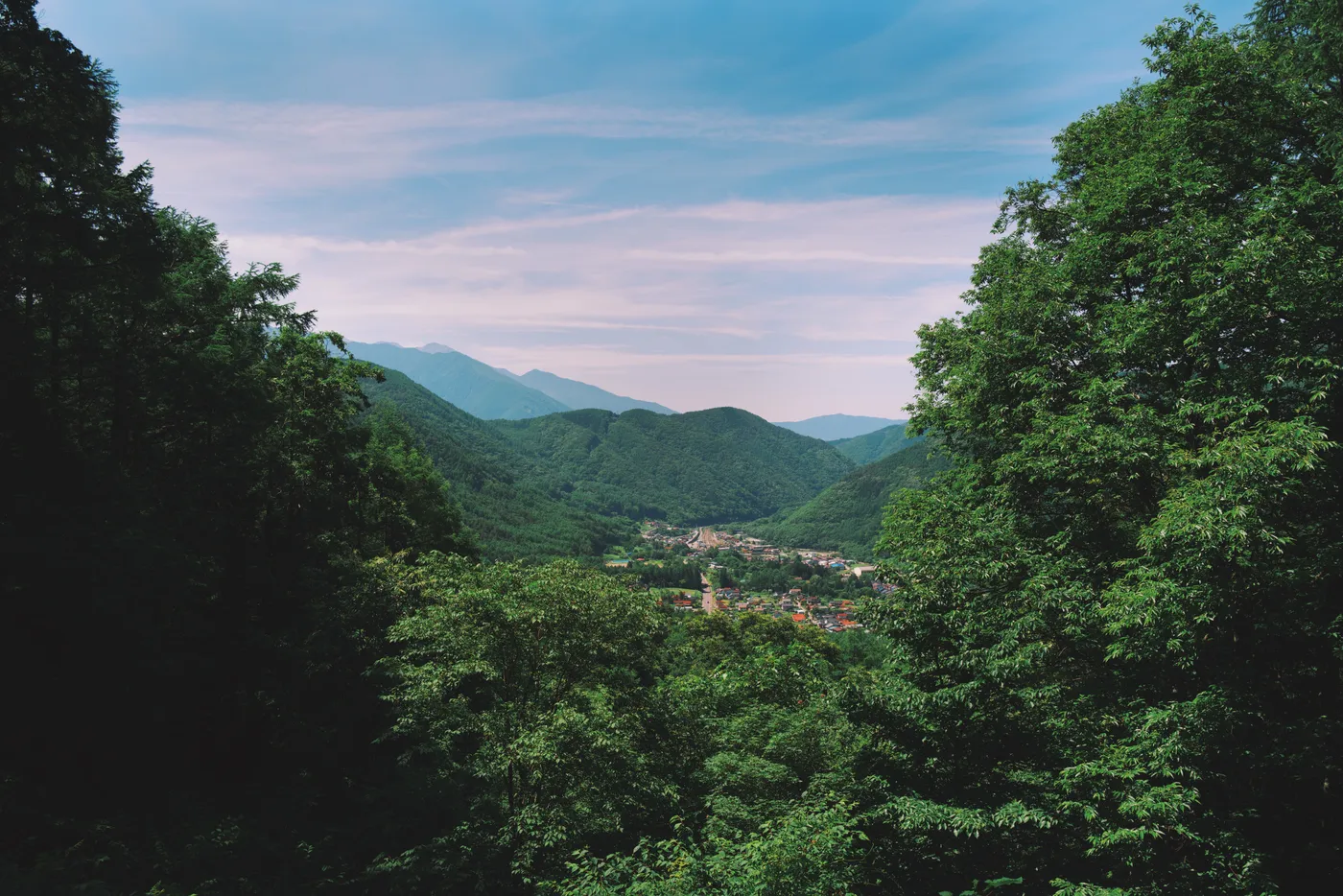
As the peak gave way to the valley floor, the deep forest opened into massive boulders lining the river and small hamlets holding on to their last few residents. The swollen river was a hint of what was coming: the last hour of the walk was through an intense rainstorm, arriving at Ame Nakasendo, just south of Nagiso.
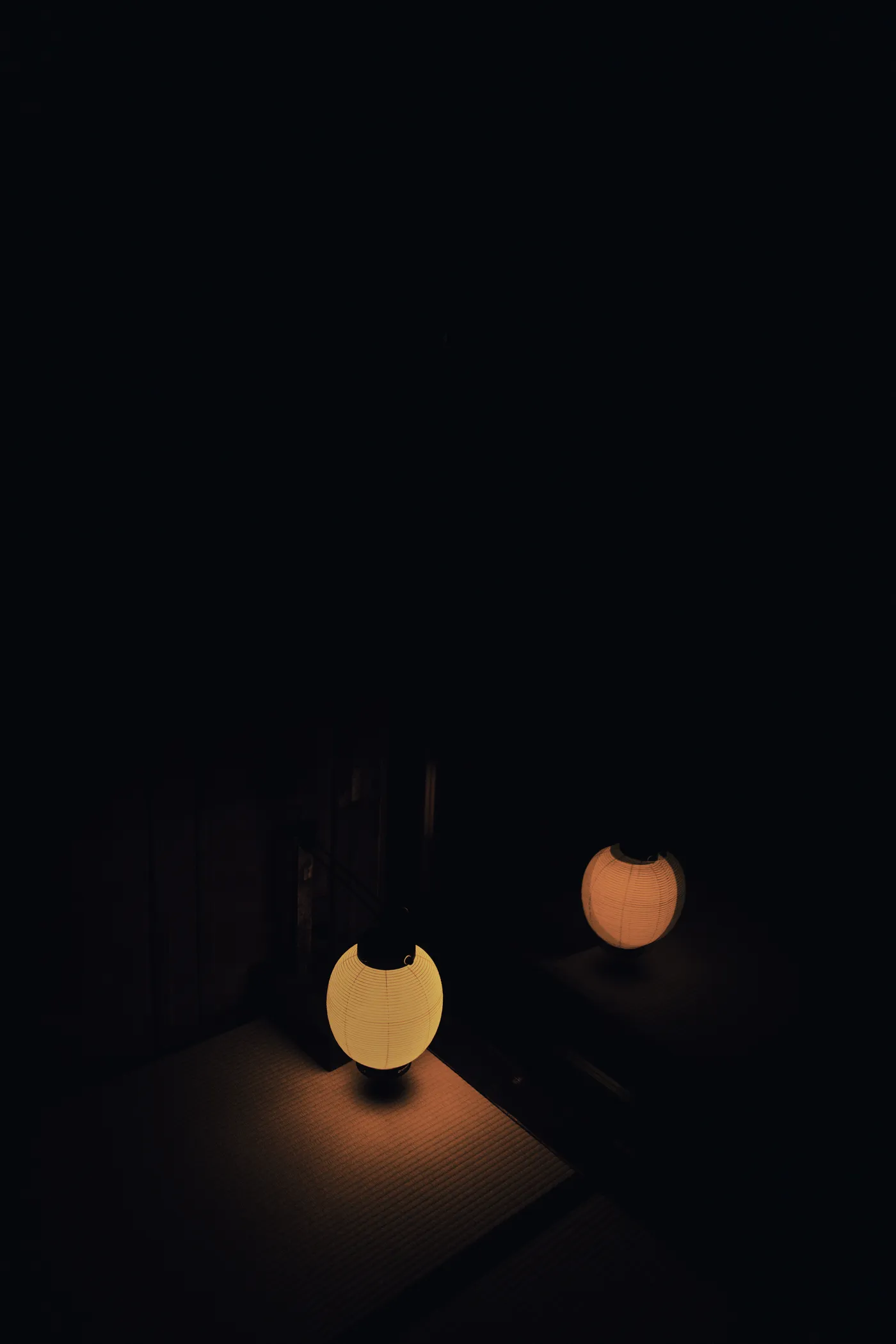
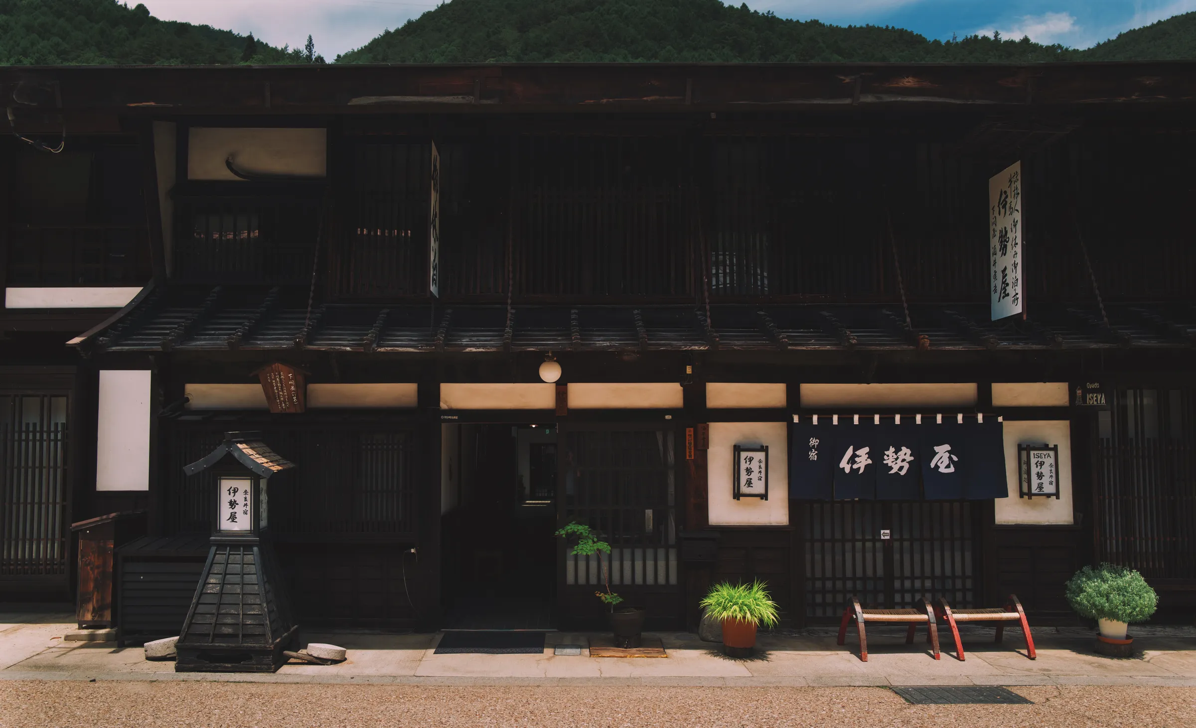
Ame Nakasendo is a recently restored kominka — a traditional farmhouse — that serves as a resting point for walkers. The front of the building is a café; the back, a generous and beautifully furnished house. That evening the owners served dinner, and I sat watching the bamboo and cedar disappear into the night.
Into the Valley
木曽谷
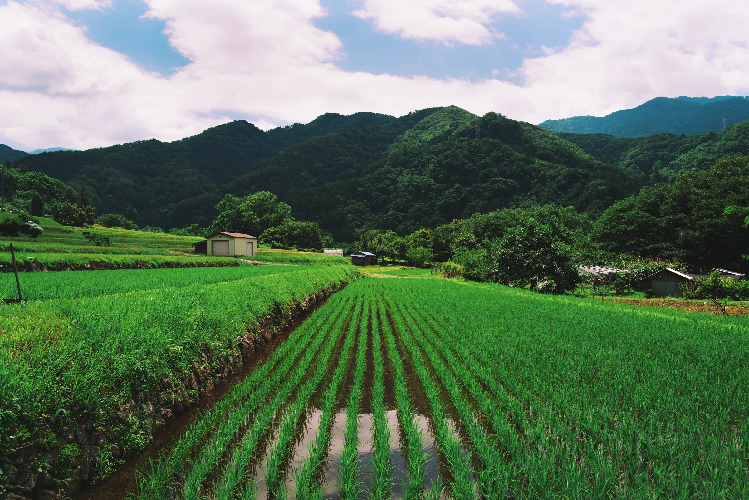
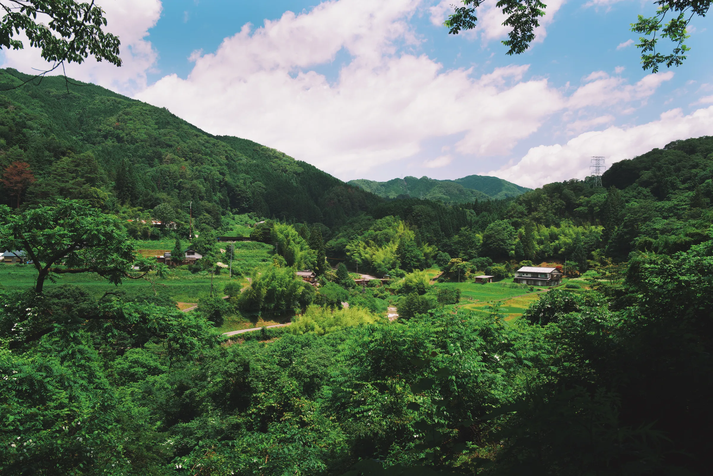
The following morning I left early, heading north through Nagiso and into another section of steep ascent — mile after mile of rice farm broken up by stretches of thick forest wherever the land was too steep to cultivate. It was the hottest section of the walk, with long exposed stretches along the road and no shade, until a bench and a miraculously cold vending machine appeared in time to prevent the day becoming a medical event.
The route snaked back and forth across the Kiso River, each crossing offering a new view up and down the waterway — littered with rocks, lined with grand cedars.
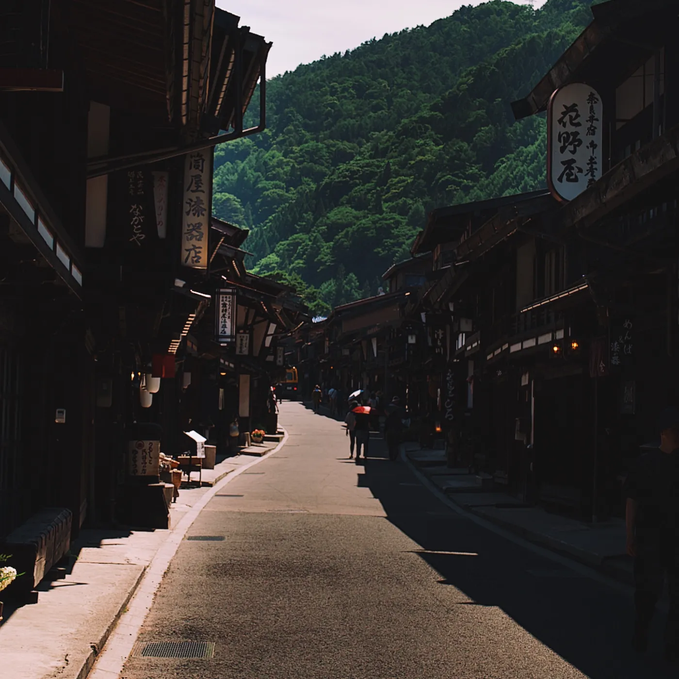
I arrived in Tsumago around midday. This was the first Nakasendo post town to be formally preserved, in the 1960s, and it has been maintained with total commitment ever since — not a satellite dish or air conditioning unit in sight. Tsumago is probably prettier now than it ever was when the people walking through here did so for work.
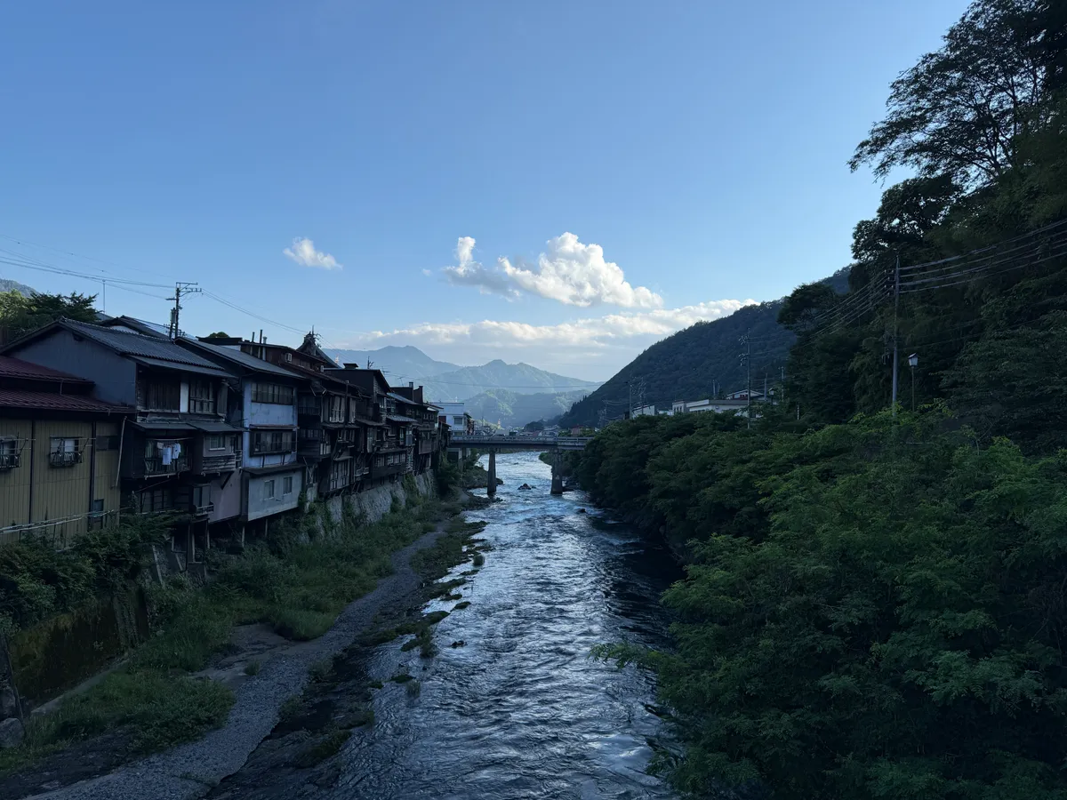
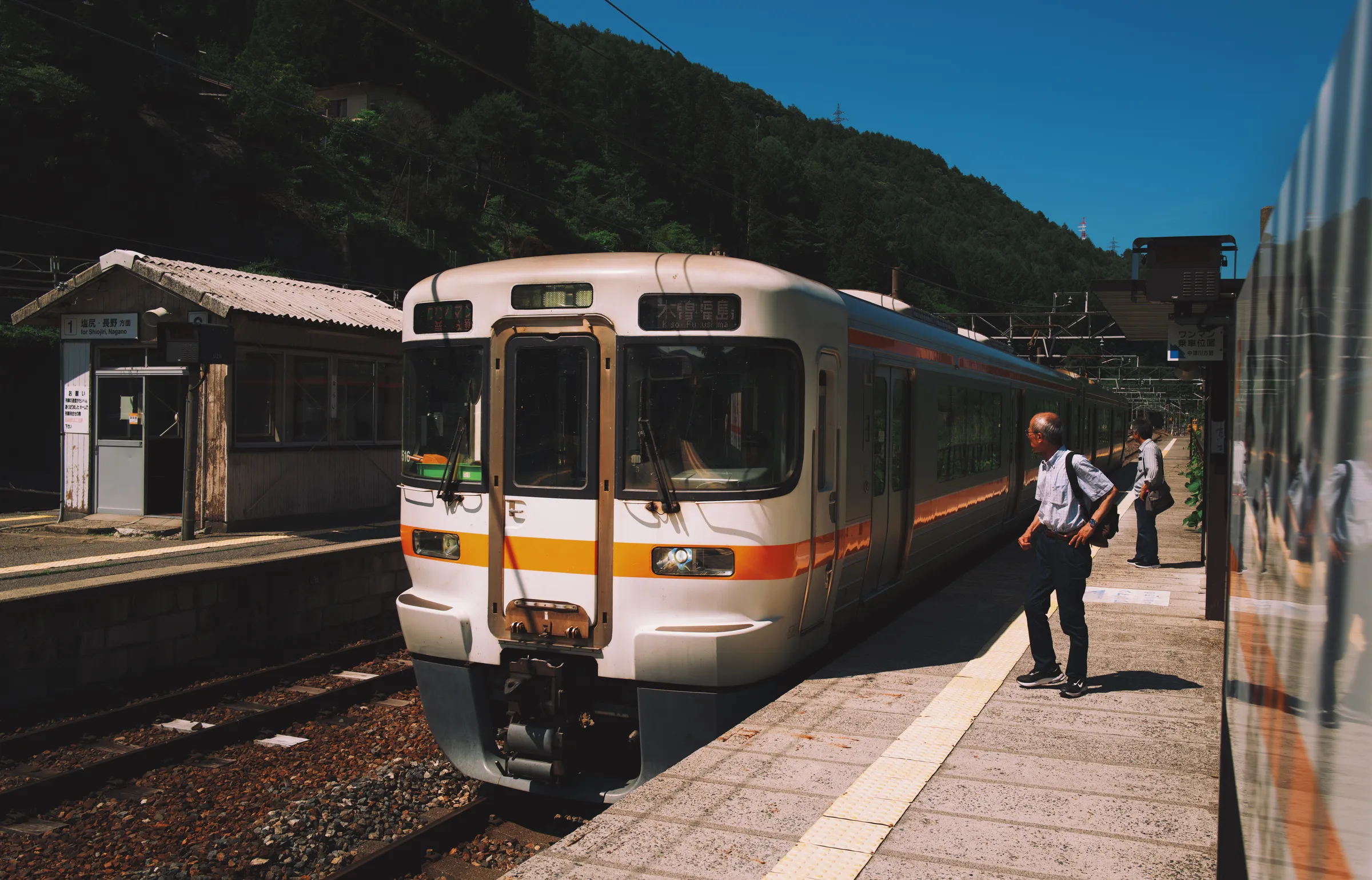
The next section was a long descent to Nojiri, through what seemed to be a more actively managed forest, with a road snaking back and forth along the river gorge for what felt like hours. At Nojiri I caught the train north to Kiso-Fukushima.
“I had been warned that the route was too hot to walk in June, and was relieved to find it almost entirely to myself.”
Kiso Road · June 2025
The Pass
鳥居峠
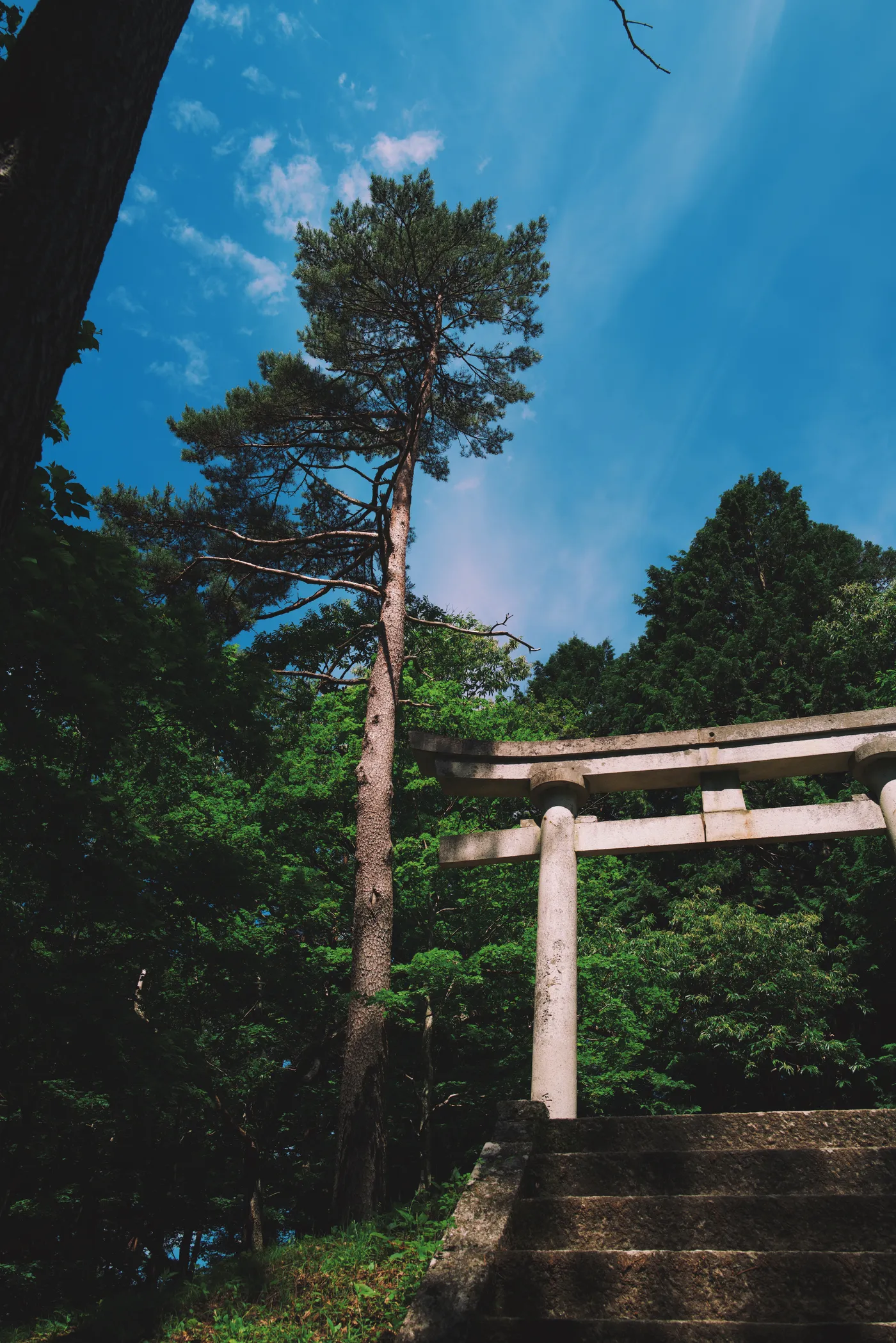
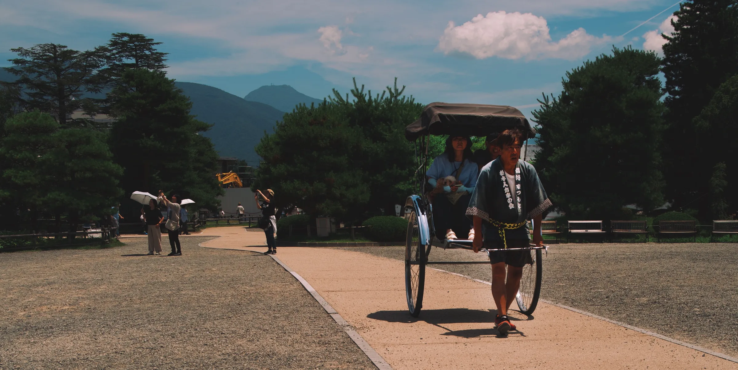
I started the next day in Kiso-Fukushima with a traditional breakfast and a visit to the onsen. After which I took the train to Yabuhara and began the steepest section of the walk: the climb to Torii Pass at 1,201 metres, and the rapid descent to Narai on the other side. This section was tough, but in a way that invited effort, and so I jogged halfway up the trail before slowing to admire the shrine at the summit.
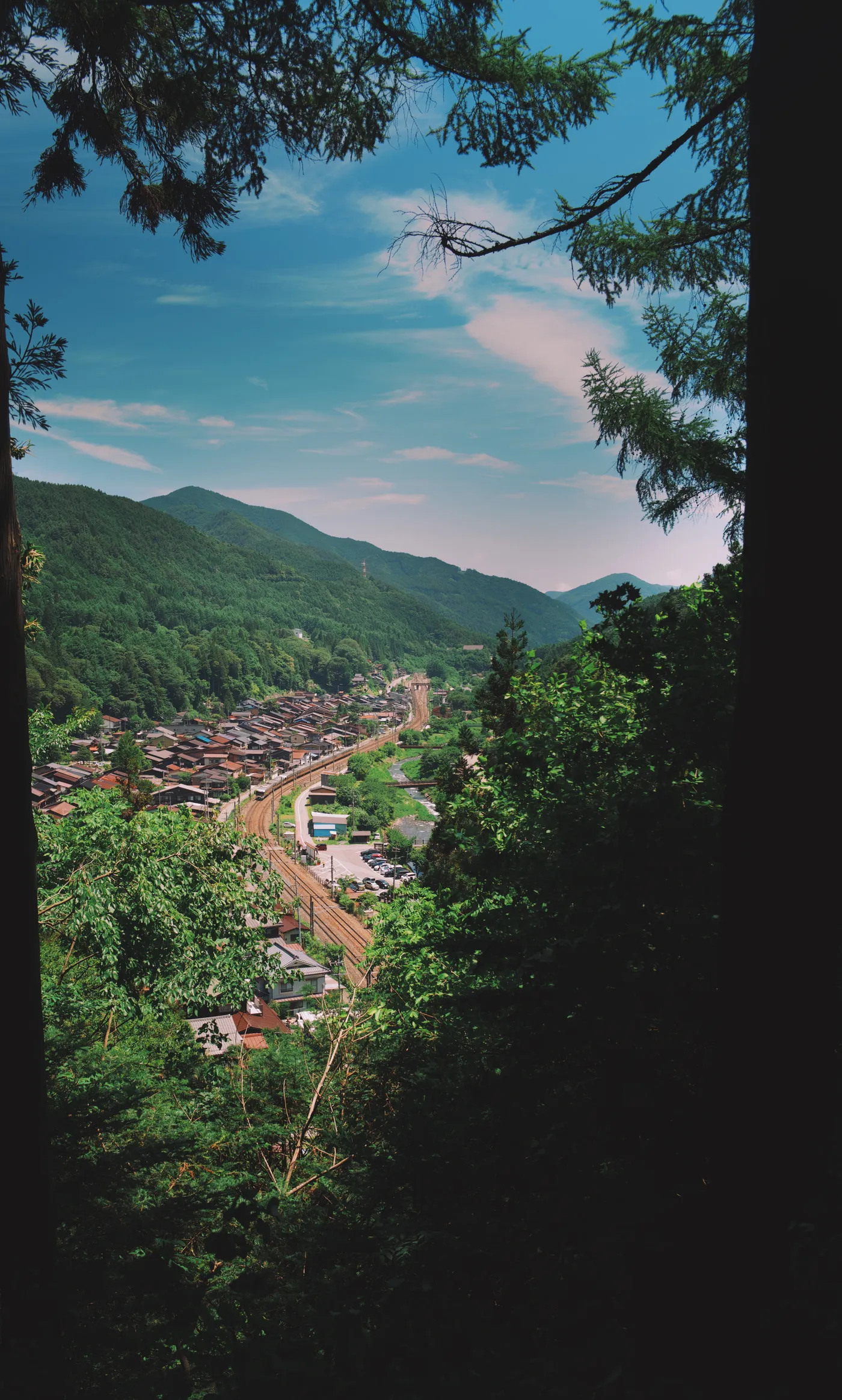
Perhaps because the terrain here was the most unforgiving, this section of the trail felt the least like the well-worn path it is. As I curved up around the mountain, tree roots and rocks emerged from the soil, and the trail narrowed before opening up to a view of Narai from above, looking straight down the main street and the railway line built alongside it.
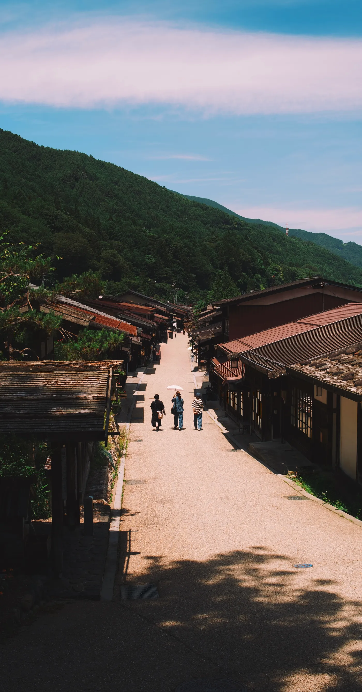
The Chuo main line opened through the valley in 1912. The towns lost their purpose overnight, and for many decades their population. What remained was the architecture — and what the architecture eventually attracted was a different kind of traveler: people walking the Nakasendo not because they had to, but because the walking itself was the point.
Morning walkers, 奈良井宿 · Leica Q2 · 28mm · f/5 · 1/400s · ISO 100 · 28 Jun
The Preserved Towns
奈良井宿・妻籠宿
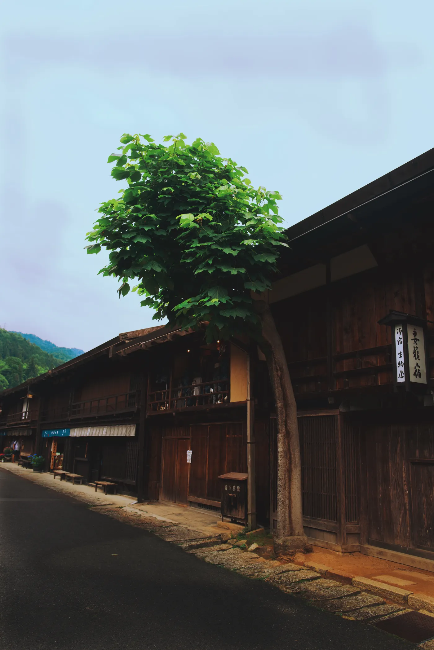
Narai-juku is the longest of the surviving post towns — longer even than Tsumago — and less formal, its preservation mixed with the ordinary commerce of a small mountain town. There is a kissa serving syphon coffee and buttered toast, a hardware shop, a middle-aged couple posing for wedding photographs.
I lingered for a few hours — coffee, ice cream, lunch, a beer — before catching the train back to Kiso-Fukushima for a second night, and the train on to Matsumoto the following morning.
The post towns are living history by now — each one subtly uncanny. Alive enough to feel like real places, but so stripped of the furniture of modern life as to feel faintly like a theme park: no satellite dishes, no vending machines, no overhead cables. The effect is deliberate, and it works.
What is strange about them is not the absence of modernity — you notice that and then adjust — but the presence of people living completely ordinary lives inside a protected historical environment. A woman hangs washing between dark timber uprights. A man parks his kei truck in the designated parking space and walks back to his house along the Edo-period road. The anachronism runs in both directions.
Most writing about the Nakasendo is about the towns. To me they felt not like the destination but the punctuation. It was in the high valleys, the thick forest and the deep river gorges where I found myself lingering — where the walk felt like having arrived.
The Train Out
出発
The train back from Narai to Kiso-Fukushima takes fifteen minutes — the same stretch of valley that had taken a day on foot. A tunnel, a car park, a supermarket glimpsed through the window. Then the valley opens, the mountains step back, and then on to Matsumoto.
There is a particular quality to the end of a walk: the body still carries it, the mind has already moved on. I spent the afternoon moving through the city at a pace that felt slightly out of place — too slow for a tourist, too purposeless for someone with business. The walk ended, properly at Old Rock with a couple of beers and a Sanzoku-yaki.
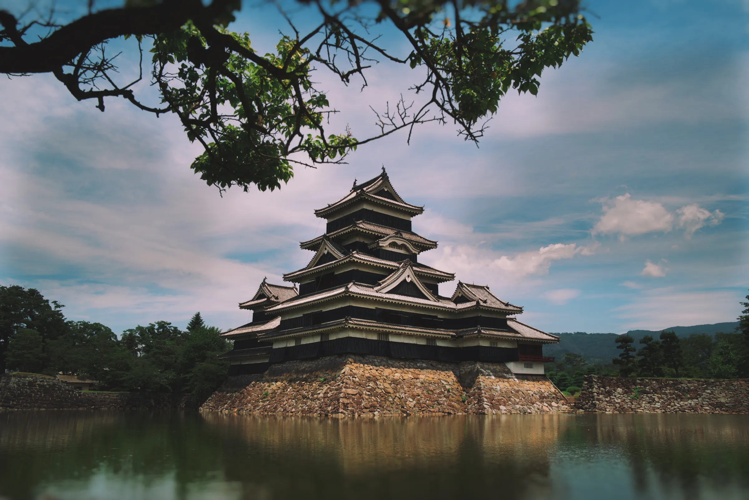
Matsumoto Castle was built in the sixteenth century and has never been destroyed. It stands in its moat at the centre of a city that has grown indifferently around it, its black tenshu rising against whatever sky the season provides. The morning before the train, there is time for one circuit of the moat, beneath the branches at the water's edge. There will be a next time — slower, further south.
Route
馬籠宿 → 妻籠宿 → 三留野 → 野尻 → 奈良井宿
Kiso Valley, Nagano Prefecture, Japan
Flights
KL 1004 · LHR → AMS · 24 Jun
KL 861 · AMS → NRT · 24 Jun
AF 187 · HND → CDG · 1 Jul
AF 1180 · CDG → LHR · 1 Jul
Camera
Leica Q2 · Summilux 28mm f/1.7 ASPH
iPhone 16 Pro Max
All photographs © Stuart Frisby, June 2025
Distance & Time
Approximately 80 km over five days
27 photographs · 25–29 June 2025
Accommodation
Onn Nakatsugawa · 25–26 Jun
ame nakasendo · Magome · 26–27 Jun
Kisoji no Yado Iwaya · 27–29 Jun
Matsumoto Marunouchi Hotel · 29–30 Jun
Coffee
Riverbed Coffee · Nakatsugawa · 25 Jun
Hirubiri Coffee · Magome · 26 Jun (×2)
Cafe Kappe · Magome · 26 Jun
好日コーヒー · trail midpoint · 440m · 26 Jun
Luggage
NLTS Luggage Transfer
Nakatsugawa → Magome · 25–26 Jun
Magome → Narai · 26–27 Jun
Matsumoto
好日山荘 Kojitsu Sansou · outdoor gear
Maruzen · bookshop
Old Rock · craft beer